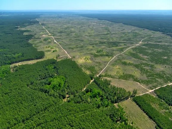
Monitoring deforestation using satellite technology

Large forest areas monitoring is presently feasible with satellite remote sensing as opposed to time-consuming and expensive ground surveys as an alternative. Deforestation and forest degradation account for about 10% of global CO2 emissions.
The availability of Earth observation information enables effective monitoring of deforestation efforts. This includes the detection of deforestation among wild and protected forests; determining the changes in commercial logging; identifying violations of existing land regulations; controlling economic activity in cleared areas, and analysing the consequences of deforestation.
While a large-scale and long-term energy transition away from fossil fuels is expected to take a few decades still, it is estimated that tropical forest conservation and restoration could reduce up to half of the total carbon emissions.
Due to climate change impacts, deforestation is now threatening the future of the economy on a global scale. Scientists have used satellites to monitor deforestation levels for several decades, which over the years have highlighted shifts in the pace and location of clearing.
In the 1900s the Brazilian rainforest was, at times, losing more than 20,000 square kilometres per year. However, public pressure turned the tide in 2004 following years of exceptionally swift deforestation. This was the same year that the Brazilian government implemented a policy that strengthened environmental enforcement agencies and increased satellite monitoring systems.
Forest monitoring satellites played a key role in slowing deforestation, providing a level of transparency and accountability that made it possible for the field of science, non-governmental organisations, and the public to engage.
Satellites designed to monitor deforestation can send deforestation alerts to enforcement officers in near real-time. Such technology means that environmental authorities are likely to notice if large areas of land are cleared, with enforcement agents following thereafter.
In one recent analysis of Landsat observations, it was found that the number of large new clearings measuring greater than 50 hectares in the Amazon declined by 46 percent between 2001 – 2007, and 2008 – 2014.
Altitude offers a unique perspective; the advanced combination of optical and radar satellite technology offers unbiased imagery which can assist field operatives who can prevent farmers from cutting trees and settling in protected forests, parks, or reserves.
While satellites have enabled deforestation monitoring, to efficiently make use of the data gathered from such satellites to identify deforestation non-compliances, several other aspects need to be considered.
Information concerning land or concession ownership and management oversight is imperative to the prevention of deforestation; without such reference points, further investigation, or action in response to deforestation alerts cannot be carried out, as is the ability to identify and engage with land owners.
Additionally, it is crucial to be able to refer to or verify changes that have taken place in affected areas to gain the best insight. Without verification as part of the process, a retrospective satellite image is essentially a photograph of the past.
In more recent years, James Crawford has designed an algorithm that detects small alterations in the landscape undetectable to the human eye, which will allow for illegal clearing of protected areas to be detected much earlier, therefore enabling activists and government officials to prevent even more damage.
Satellite imagery information can also be utilised for fire monitoring and management which is particularly useful during dry seasons. Under such technology, specific ‘hotspots’ can be monitored daily, relaying information to on-site conservation management teams who are able to verify the data received from the satellite imagery.
Utilising satellite technologies in such a way has significantly improved rates of early detection of fires and has raised the effectiveness of rapid response teams.
Regular monitoring of deforestation is an urgent responsibility for many countries around the world, and the availability of relevant and reliable information ensures effective monitoring of compliance with the legislative acts providing protection and sustainable use of forests, wildlife, and the existing forest regulations.
References:
1. Eco-Business (2019), Monitoring Deforestation: The Use and Misuse of Satellite Technology
2. Un-Redd (2019), Combatting Deforestation Using Satellite Technology
3. Earth Observatory NASA (2019), Tracking Amazon Deforestation from Above
4. Wired (2015), Using Satellites to Stop Deforestation Before It Happens
5. We Forum (2018), Satellite Imagery is Helping Governments to Combat Deforestation
6. Wilmar International (2019), Sustainability Brief on Monitoring Deforestation
7. MDPI (2018), Monitoring Deforestation in Rainforests Using Satellite Data
8. IOP Science (2019), Automated Detection of Deforestation Based on Multi-Spectrum Satellite Data


